Introduction
I do not typically use this blog to discuss personal events except as a framework to discuss the photographic techniques I used to create the images I discuss about a particular photo trip. However, I will make an exception in this case and discuss my vacation to New Zealand and French Polynesia in January, 2013 with as much focus on photography as I can.
Here is a direct link to the New Zealand photo gallery.
New Zealand
I departed LAX on Saturday January 5 around 10 PM and landed at AKL on Monday January 7 at 8 AM or so. From there I waited a few hours and then boarded a flight to Queenstown on the South Island. The overnight flight and morning arrival coupled with my extra-cost super economy seat meant I was not jetlagged in any way. I carried my new camera, a Canon 6D, which is an “affordable” full frame sensor D-SLR with both WiFi and GPS built-in. I also brought my trusty 24-105 f4 IS lens and my 50 mm f1.4.
South Island
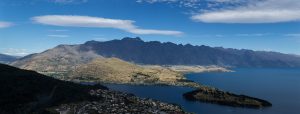
Queenstown is the center of the NZ action sports/activities universe. In winter it is a ski resort destination, in the summer it is the bungee jumping, jet boating and zip-lining capital. It is also in the middle of some utterly spectacular scenary – the Remarkables mountains and Lake Wakatipu. Nearby is Lake Wanaka and Mt Aspiring with the Rob Roy glacier – very alpine.
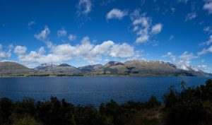
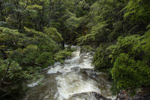
Queenstown is at roughly the southern latitude as Portland, OR is north – 45.5 degrees – and has the same weather. This meant that the weather was cool and cloudy with rain and snow at the higher elevations for part of the first week. It was nice weather for hiking and roadtripping, but not for photography. The only exception was some forest images I took while hiking a trail (Kiwis call them “tracks”) to Mt Creighton near Lake Wakatipu. Forest light filtered by rain clouds is less intense and allows for interesting light and dark interplay due to the low contrast environment.
My first few days were in the Queenstown area, driving along Lake Wakatipu to the western end at Glenorchy, taking a cable car up a mountain to get an alpine overview of the entire town, the lake and the surrounding mountains and then later when the weather cleared for a few days driving to Lake Wanaka and Mt Aspiring National Park. I also went out Fiordland National Park and Lake Manapouri.
I had planned a cruise on Milford Sound but the weather did not cooperate and that activity had to be cancelled.
Ultimately the South Island weather cleared up and presented many opportunities to explore, be awed by and photograph some of the most incredibly beautiful scenery I’ve ever experienced.
North Island
After a week of fun on the South Island I flew from Queenstown to Auckland and then went by car to Cambridge, a town near Hamilton. Cambridge is near a town called Te Awamutu, the home town of a favorite musician of mine, Neil Finn. The main library in that town includes a small museum, and in the museum is a “shrine” to the Finn brothers, Neil and Tim. I went there for an hour or so one day. I also visited a very pretty seaside beach town called Taurunga, whose main geological feature besides the coastline is a small dormant volcano cone called Mt Maunganui. The North Island is still volcanically active; not only is Auckland surrounded by dormant volcanoes but there is a small thermal public bath at the base of Mt Maunganui.
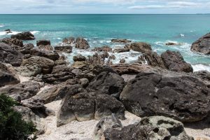
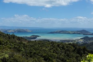
I learned to drive one day and then took a borrowed car on my own out to a region called The Coromandels, which is a lightly populated peninsula of vacation beach towns and beautiful rain forest. A few days out there was not enough time, but I managed to drive the entire paved highway (highway 25). The rest of the peninsula is reachable only by gravel road, something I was not willing to drive on with the car. If you click on the linked map, you’ll see that this sparsely populated, very wild and natural area is only about 20 or 30 miles across the bay from Auckland. Highlights of this part of the trip were definitely Cook’s Beach and Hot Water Beach and Mercury Bay.
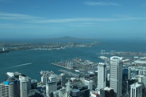
I wrapped up my second week in New Zealand by seeing Elvis Costello and the Imposters live in Auckland, staying in the city through the weekend then flying to Papeete, Tahiti, French Polynesia that Monday morning.
French Polynesia
Here is a direct link to the French Polynesia photo gallery.
Tahiti
I flew from Auckland, New Zealand to Papeete, Tahiti, French Polynesia. I departed Monday morning 10 AM and arrived in Papeete (Faa’a International Airport) at about 4 PM Sunday afternoon. Papeete is the capital city and is the “Honolulu” of French Polynesia. Tahiti itself is the largest island. I stayed overnight on Tahiti and in the morning I took a puddle jumper aircraft from Faa’a to Moorea’s airstrip, a 12 minute flight.
Moorea
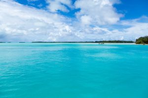
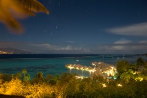
Moorea is 12 million years older than neighboring Tahiti and the volcanic crater erosion and barrier reef demonstrate its age. I was staying on Cook’s Bay. I was visiting French Polynesia at the lowest of the low season; there were a grand total of 6 people in my hotel. It meant I had the place to myself, basically and no one seemed to really care. The weather was not very good; it rained in a monsoon the night of my arrival and it was gray and drizzly the first full day on Moorea, but eventually the clouds dissipated and the sun came out. I was able to get a lot of beautiful images by renting a car and driving around the island and taking a boat ride. I even did some long exposure timelapse images one night. I was on Moorea 3 nights and had a good time.
Bora Bora
I then flew to Bora Bora, which is the classic South Pacific tropical island but was a bust for me. The weather did not cooperate at all, the island was under a hurricane warning (it was 500 km away but it meant the hotel reduced some of their services) and it wasn’t as much fun as Moorea. Eventually I got sick, probably from drinking the water. I was there two nights and flew back to Papeete and then home the same day.
